
What is the “Public Trust”
and how does it affect beach access in Fairfield?

[Part 1]
Introduction and Overview
The Public Trust Doctrine is a legal principle (environmental law) derived from English common law.[1] The essence of the doctrine is that the waters of the state are a public resource owned by and available to all citizens equally for the purposes of navigation, conducting commerce, fishing, recreation and similar uses; and that this “trust” is not invalidated by private ownership of the
underlying land.
As a transformative principle, the doctrine imposes obligations that limit public and private use of tidelands and other shorelands in order to protect the public's right to use the waters of the state.
All coastal states as sovereigns (supreme power or authority) hold the submerged lands and waters waterward of the mean high water line in trust
not only for their own citizens, but for “the public.”
The public trust doctrine is recognized as a background principle of property law, limiting landowners' reasonable expectations without necessitating constitutional compensation for lost development rights.[7] As a “principle of accommodation,” it ensures a balance between public and private rights, facilitating public use and preservation of natural resources while respecting private property. [8]

The public trust doctrine is a central issue to beach access, yet Fairfield signage makes no accommodation for that...
"ordinary high water mark"

John William Waterhouse: Miranda, The Tempest (1916)
The doctrine has been legally interpreted to support use of the intertidal zone (see below) for relief from the pressures of life in modern society, and the parallel enjoyment of nature’s beauty. Protection of the trust is a duty of the state, and as such, Connecticut’s government is required to maintain it for reasonable use by the public.
The Public Trust Doctrine does not allow the public to trespass over privately owned uplands to access the tidelands. It does, however, protect public use of navigable water bodies below the “ordinary high water mark” (OHWM).
According to the State of Connecticut Department of Energy & Environmental Protection (DEEP): “The general public may freely use these lands and waters, whether they are beach, rocky shore, or open water, for traditional public trust uses such as fishing, shell-fishing, boating, sunbathing, or simply walking along the beach (emphasis added). In Connecticut, a line of state Supreme Court cases dating back to the earliest days of the republic confirm that private ownership ends at mean (average/ordinary) high water line/(mark), and that the state holds title o the lands waterward of mean high water, subject to the private rights of littoral
or riparian access.” [2]
Put another way, this area, as a natural resource, is analogous to a “public highway” that, given upland access, any citizen of the state may transverse laterally.[3]
So WHAT IS the public trust area?
HOW do I know if I am legitimately
walking my dog off-leash?
At Fairfield beaches, once upland access is granted (that is: between October 1 and March 31, when dogs and horses are permitted to accompany “responsible persons” pursuant to §14 of the Fairfield Parks & Recreation Commission Rules and Regulations: Beaches), it is reasonable to interpret that a person may walk with their dog OFF-leash while within this “Public Trust area,” or more simply, below the OHWM.
As defined by the DEEP (The Public Trust: What are the public's rights along Connecticut's shore?): “The public trust area comprises submerged lands and waters waterward of the mean (average/ordinary) high water line (OHWM) in tidal coastal, or navigable waters of the state of Connecticut. On the ground, the public trust area extends from the water up to a prominent wrack line, debris line, or water mark. In general, if an area is regularly wet by the tides, you are probably safe to assume that it is in the public trust.”
The Public Trust area is also sometimes referred to as tidelands or tidal flats, and is defined as “public beach” by The Connecticut Coastal Management Act, CGS 22a-93(6).[3]

Put another way, this area, as a natural resource, is analogous to a “public highway” that—given upland access—any citizen of the state may transverse laterally.

"Public Beach" is that portion of the shoreline that is below the mean high tide elevation...
What is the
"Mean High Water Mark"?
The mean or average high water mark is commonly interpreted as merely the “high water mark” as a matter of legal or administrative practicality/convenience (as it is in signage at Fairfield beaches); but it is important to understand the term more particularly.
The Mean/Ordinary High Water Mark (MHWM or OHWM) is the average of all the high water marks observed over a period of years. In the US, this period spans 19 years (an epoch) and is referred to as the National Tidal Datum Epoch (NTDE).
NTDE is the specific 19-year period adopted by The National Oceanic and Atmospheric Administration (NOAA), National Ocean Service, Center for Operational Oceanographic Products and Services (CO-OPS) as the official time segment over which tide observations (sea levels) are taken and reduced to obtain mean values (e.g., mean high/er or low/er, etc.)
for tidal datums.
The OHWM is under the current epoch (1983-2001); NOAA plans to release the data for the 2002-2020 epoch in 2025.

This definition is wrong, but is used as a matter of legislative convenience and for ease of communication...
WHAT IS a "Tidal Datum"?

NOAA graphic: tidal datum (see also: footnote #7 on our tide calendar page for further explanation).
A datum is a reference elevation of the sea surface from which vertical measurements are made, such as depths of the ocean and heights of the land. The intersection of the elevation of a tidal datum with the sloping shore forms a line used as a horizontal boundary. In turn, this line is also a reference from which horizontal measurements are made for the construction of additional coastal and marine boundaries. A tidal datum is the vertical reference based on a phase of the tide.
Standardization is necessary because of periodic and apparent secular trends in sea level.
The present NTDE is 1983 through 2001 and is actively considered for revision every 20-25 years.
Tidal datums in certain regions with deviating sea level changes (Alaska, Gulf of Mexico) are calculated on a
Modified 5-Year Epoch.
The mean high water is the mean (average) of all high water heights observed during current NTDE.
What is the"WRACK LINE"?
How Do I Recognize It?

The average of high tides over the span of an "epoch" becomes the "ordinary high tide" mark, and defines the public trust area (Penfield Beach)
The wrack line (or tidal wrack), marks the “fluctuations of tidewaters” delineating the OHWM, and is the line of dead or dying seaweed, marsh grass and other debris (including litter) left on the upper beach by the preceding high tide.[5]
Below this line: is the Public Trust area.
There may be other lines of wrack higher up, created by former spring or storm tides, but the lowest line will often tell you the limit of the last high tide (see illustration, below), except if that tide does not wash away earlier wrack.
Wrack from an unusual or seasonal storm or hurricane is not generally regarded as representative, because it is not factored into calculating the datum. In this instance or in unseasonably warm weather, when the beach may be crowded, asserting your (off-leash or otherwise) right to this area may become problematic.[5] To avoid an infraction, if in question, a conservative judgement is practical: our monthly tide calendar can provide guidance.
Then… who holds responsibility for law enforcement within the public trust area? As public property that is under stewardship of the State, Connecticut State Police hold primary jurisdiction within the public trust area. The practicality, however, of anticipating State Police to present themselves (especially at the moment of importance) is obviously problematic. Upon a complaint, Town of Fairfield Police may therefore request permission (direction) of the State Police to intervene on their behalf, and this would likely be considered as an ordinarily accepted agreement. For this reason, it would seem plainly wrong to assume that Fairfield Police have “no jurisdiction” to act within the public trust area.
Further, it should be expected that broad leeway would be agreeable to both for interpreting how local and state interests and regulations would overlap and compete, given the contiguous and changing nature of the local/public (state) trust boundary. Indeed, an emergent situation may involve interests (and jurisdiction) of both.
Clearly, however, it is the local authorities who are logically able to respond most immediately. If, for example, a person were within the public trust area but conducting themselves in a manner which would ordinarily violate state public nuisance definitions, local Fairfield ordinances (examples: littering, intoxication, or engaging in behavior typical of “disorderly conduct;” or, in a manner that endangered the safety, well being, or property of others—on either or both sides of the trust area); or, behavior commonly recognized as “public nuisance,”[6] Fairfield Police may clearly expect not only permission but direction from CT State Police to intercede on their behalf. More logically, a standing agreement to accommodate this ongoing need would already be in place.
Signature case:
Illinois central railroad

Danny: deftly straddling a legitimate off-leash outing on Penfield Beach...
The US Supreme Court issued its landmark opinion on the nature of a state’s title to its tide and submerged lands over 100 years ago: Illinois Central R.R. Co. v. Illinois (1892) 146 U.S. 387, 452.
The dispute arose over the title of lands occupied by the Illinois Central Railroad Company's tracks, stations, piers, & other constructions along the Chicago lake front.
In fact, the legislature had given the railroad company (a private corporation) title including the bed of Lake Michigan, however, the State argued that it held original ownership & control of those submerged lands. The Court held that the legislature could not divest the State of its ownership, control, and responsibility for management of these regions; and that the government was required to preserve them for public use.
As discussed in the subsequent pages of this essay, various legislatures and the courts have examined and re-evaluated the parameters of tidelands trust issues since then, however, the basic premise of the trust remains fundamentally unchanged: the Court affirmed that a state’s title to its tidal and submerged lands differs from title to lands it holds for sale.
The Public Trust, therefore, is an affirmation of the duty of the state to protect the people’s common heritage of tide and submerged lands for their common use: “… It is a title held in trust for the people of the State that they may enjoy the navigation of the waters, carry on commerce over them, and have liberty of fishing,” that is, unencumbered from obstruction, or interference from private parties.
augmenting the definition
of Connecticut’s
“Coastal Jurisdiction Line”
In 2012, the Connecticut General Assembly passed Public Act No. 12-101, which included a revision to the State’s regulatory jurisdiction under Connecticut General Statutes (CGS) Section 22a-359.
This revision clarified the regulatory jurisdiction limit from the “high tide line” to the area up to and including the elevation of the “coastal jurisdiction line” (CJL) as determined for the State's major tidal water bodies.
The high tide line (HTL; see: “mean high water mark,” above) had been the State's coastal jurisdictional limit for tidal, coastal, and navigable waters since 1987. But, particularly after a storm (see: “OHWM” illustration in Notes/Additional Information, below), when the ordinarily identifiable elements of “field evidence” determination (wrack lines, vegetation patterns) were often in flux, identifying the HTL was disputable. Rather than relying on field evidence of the water surface elevation, the amended statute dictates the use of a specifically determined elevation as the regulatory limit. Nevertheless, the CJL elevations corresponded to the North American Vertical Datum of 1988 (NAVD88).
Working collaboratively, DEEP and the Connecticut Association of Land Surveyors calculated CJL elevations for each coastal municipality and the state's three major tidally-influenced rivers. The methodology isolated the orbits of the sun and moon—which can be modeled and computed—as primary actors in predicting the tide; thus, removing the effects of weather. Towns have been assigned a CJL elevation that reflects the long-term elevation of the highest predicted tide, fairly distributed along the shoreline and tidal rivers based on this more strictly isolated data. For a proposed project application, a land surveyor will find the nearest benchmark that contains an authoritative elevation in the NAVD88 datum.
The CJL does not change the definition of tidal wetlands, limited at an elevation not exceeding one-foot above local extreme high water (the elevation of the one-year frequency tidal flood as shown on the most recently adopted U.S. Army Corps of Engineers tidal flood profile), and field-determined through the identification of certain plants and the presence of tidal water. Rather, the CJL prevails for certain types of applications for dredging and filling, building of structures, and permits, including those related to emergency authorizations.

Zack: the original “Ambassador” of Jennings Beach, who provoked the creation of Fairfield Beach Access.
eNDNOTES/
Additional information:

Fairfield
public access
points
[1] For this discussion, common law refers to laws and the parallel legal system that is developed through court decisions (case law), rather than through legislative or executive action. As such, the decision in a currently pending legal dispute is dependent on decisions in similarly themed cases that have already been resolved; and in turn, it affects the law to be applied in future cases. When there is no authoritative statement of the law, judges have the authority and duty to interpret and apply (create) law, and by so doing, develop precedent for future cases. The mass of precedent (called: common law) binds future decisions, such that the parties and judges must follow the reasoning used in the prior decision (stare decisis, or “to stand by the decision”).
If the current dispute is fundamentally dissimilar to those already adjudicated (a “matter of first impression”), the court’s new decision becomes binding precedent which is used to resolve future cases.

The National Tidal Datum Epoch (NTDE)
[2] CT Department of Energy & Environmental Protection: The Public Trust: What are the public's rights along Connecticut's shore?
[3] The definition of “navigable waters” is set forth in Title 33 CFR (Code of Federal Regulations) Part 328.3, Definition of Waters of the United States. Federal jurisdiction over non-tidal navigable waters is established in: 33 CFR Section 329.11(a)(1), and utilized by USACE to administer the R&HAA and CWA regulatory programs; (see note #5, below).
[4] Approved by the National Oceanic and Atmospheric Administration, Connecticut's Coastal Management Program is administered by the DEEP under the 1972 Federal Coastal Zone Management Act (CZMA: P.L. 92-583). Enacted in 1980, the Connecticut Coastal Management Act (CCMA) codifies through statute a program to ensure neutral growth along the coast, improve public use and access, protect water-dependent uses, public trust waters and submerged lands, restore coastal habitats, promote harbor management, and facilitate research.
The Coastal Management Program also regulates work in tidal, coastal and navigable waters and tidal wetlands under the CCMA; development of the shoreline is regulated at the local level through municipal planning and the zoning boards and commissions, provided technical assistance and oversight by program staff ensuring compliance with policies of the CCMA.
See also: State of CT Dept. of Energy & Environmental Protection: Living on the Shore: Who Owns the Shore? Further, see also: public trust as created statutorily in the Connecticut Environmental Policy Act (CEPA), C.G.S. ann. § 22a-16, 22a-17; which asserts “the public trust in the air, water and other natural resources of the state” and crafts an expansive citizen suit provision allowing any member of the public to sue to protect these resources “from unreasonable pollution, impairment, or destruction.”
Duncan: low tide adds room to run free...
[5] Among other applications, the U.S. Army Corps of Engineers (USACE) establishes the OHWM as a jurisdictional benchmark for administering its regulatory program in navigable waterways pursuant to §10 of the Rivers and Harbors Appropriations Act of 1899 and §404 of the Clean Water Act.
With 34,600 civilian and 650 military personnel, USACE is the largest public engineering, design, and construction management agency in the world, and is engaged in public works support to the nation domestically and the Dept. of Defense globally. The charge of USACE is to provide military and public works services to the US through critical engineering services and capabilities, as a public service, to support the “national interest.”
US Army Corps of Engineers
identifies
15 characteristics
to identify
the “Public Trust”
USACE identifies 15 characteristics
for this purpose:
(1) natural line impressed on the bank;
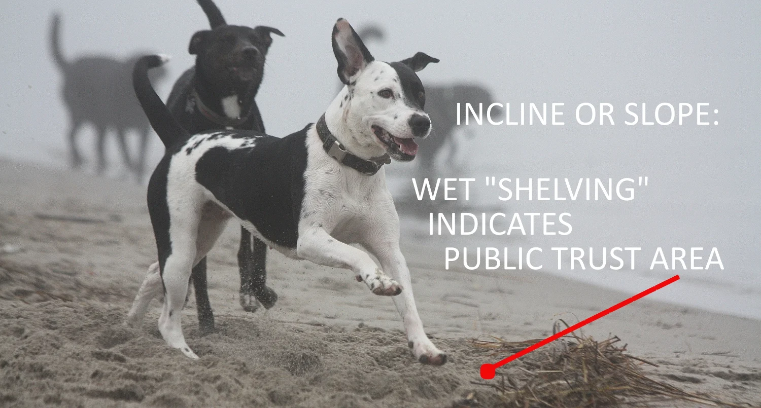
(2) shelving (incline or slope);
(3) changes in the character of soil;
(4) destruction of terrestrial vegetation;
(5) presence of litter and debris; (6) wracking;
(7) vegetation matted down, bent, or absent;
(8) sediment sorting;
(9) leaf litter disturbed or washed away;
(10) scour (erosive force of moving water);
(11) deposition of soil;
(12) multiple observed flow events;
(13) bed and banks;
(14) water staining; and
(15) change in plant community.
Further stipulated as other (but not limited to) reliable methods that may be indicative of the OHWM include: (A) lake and stream gage data, (B) elevation data, (C) spillway height, D) flood predictions, (E) historic records of water flow, and (F) statistical evidence.
The Agency does discuss that these should include “characteristics associated with ordinary high water events, which occur on a regular or frequent basis. Evidence resulting from extraordinary events, including major flooding and storm surges, is not indicative of the OHWM. For instance, a litter or wrack line resulting from a 200-year flood event would in most cases not be considered evidence of an OHWM” (USACE Regulatory Guidance Letter: 07 December 2005).
[6] Under the common law, the term “nuisance” is customarily used to describe an activity or condition that is harmful or annoying to others. The scope of application can obviously be broad and flexible according to emergent needs or interests of the state or local law enforcement bodies. The law of nuisance was created to stop such vexing activities or conduct when they unreasonably interfered either with the rights of other private landowners (private nuisance) or with the rights of the general public (Connecticut public nuisance law; CGA chap.368.)
[7] Lucas v. South Carolina Coastal Council, 505 U.S. 1003 (1992): A “taking” that requires fair compensation exists when the government creates a regulation that negates all economically beneficial use of a property, and state nuisance law would have permitted such a use.
[8] See: Blum, Michael C.: The Public Trust Doctrine and Private Property: The Accommodation Principle, Pace Environmental Law Review, Vol. 27, No. 3, 2010.
“She would come back, dripping thick water, from the green bog.
She would fall at my feet, and draw the black skin from her gums,
in a hideous and wonderful smile... and I would rub my hands over her pricked ears and her cunning elbows, and I would hug the barrel of her body,
amazed at the unassuming perfect arch of her neck... ”

Browsie: self effacing and luminous...
It took four of us to carry her into the woods.
We did not think of music, but anyway, it began to rain slowly.
Her wolfish, invitational half pounce. Her great and lordly satisfaction at having chased something.
My great and lordly satisfaction at her splash of happiness as she barged through the pitch pines
swiping my face with her wild, slightly mossy tongue.
Does the hummingbird think he himself invented his crimson throat? He is wiser than that, I think.
A dog lives fifteen years, if you’re lucky.
Do the cranes crying out in the high clouds think it is all their own music?
A dog comes to you and lives with you in your own house,
but you do not therefore own her,
as you do not own the rain or the trees,
or the laws which pertain to them.

Fannie: shore speeder...
Does the bear wandering in the autumn up the side of the hill
think that all by herself she has imagined the refuge and the refreshment of her long slumber?
A dog can never tell you what she knows from the smells of the world,
but you know, watching her,
that you know almost nothing.
Does the water snake with his backbone of diamonds
think the black tunnel on the bank of the pond
is a palace of his own making?
She roved ahead of me through the fields, yet would come back, or wait for me, or be somewhere.
Now she is buried under the pines.
Nor will I argue it, or pray for anything but modesty, and not get angry.
Through the trees there is the sound of the wind, palavering.
The smell of the pine needles, what is it but a taste of the infallible energies?
How strong was her black body!
How apt is her grave place.
How beautiful is her unshakable sleep.
Finally, the slick mountains of love break over us.
—Mary Oliver: “Her Grave”

Bailey: thoughts of yesterday... yesteryear...